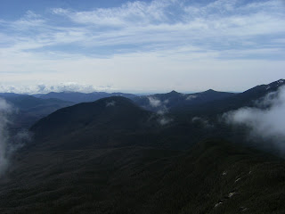
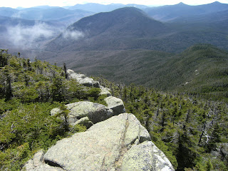
The Plan: Rand, Gunn and myself spend a weather-perfect day hiking to the summit of Mt Garfield to enjoy the spectacular view of the entire Pemi Wilderness including over a dozen 4,000'+ peaks.
The Reality: Not that far off from "The Plan" - Gunn was too sick to make it, and we encountered light rain for the hike from the trailhead to just below the summit. But with a bit of patience, the rest of The Plan was achieved.....
At home, the previous day's rainy weather appeared to be clearing up as I headed out at 04:30 to pick up Rand. And the further north we drove, the better the sky began to look. By the time we stepped out of Peg's Diner in Woodstock, there were large patches of blue sky and the air temp was up to 50.
But I've learned over the years that if you're heading north of Franconia Notch, you can NEVER assume that what you see in Woodstock is what you'll find in Twin Mountain, just 10 minutes north of the notch.
As we approached the notch, the cloud covered filled in. The ground fog was so thick that visibility was about 50 yards and the rain got steady and a bit heavy at times. I hoped that this was simply a case of "Notch Weather", and that all would be well once we got to the other side. And it did, a bit anyway. The rain was light but the ground fog and clouds were still pretty thick.
We picked up the fire road off route 3 and drove the mile or so to the Garfield Trail parking area. By this time the precip was just a mist, and fortunately never grew much in strength from that point on...
From here it would be 5.0 miles and exactly 3,000' of elevation gain to the summit...
With virtually all of the snow in the area having melted a few weeks ago, the two crossings we had to make over Spruce Brook were not much of a challenge...
From this point until we reached the ridgeline just below the summit, the precip was just enough to force me to tuck the camera away. I did make it a point to take some shots on the way down, and some are posted below.
We arrived at the ridgeline where the Garfield Trail ends at the Appalachian Trail in only 2.5 hours - over an hour under 'book time'....
And that was a good thing as we would need to spend over 2 hours at the summit waiting for the clouds to lift so we could enjoy what is commonly referred to as "the best view in the White Mountains". While we waited, we shot pics of the rolling fog that would occasionally allow a quick peek at a peak...
The rain had stopped and the air temp was warm enough that it was a pleasant 2 hours at the summit. And the bottle of homebrewed mead that Rand brought made the wait even more enjoyable...
But there was a lot of long stretches of nothing to see, so the mind wonders and the pictures get a bit strange, such as.....
Me enjoying my traditional summit cookies - Pepperidge Farms Double Chocolate Milanos....
....random backpack shots....
....hiking poles resting on the former fire tower's concrete foundation...
....FEET!!.....
But as I said at the beginning, our patience was eventually rewarded. Sadly these pictures cannot truly share the amazing beauty of this spot. Mt Garfield is situated directly at the northern point of the Pemigawasset Wilderness. Looking south/east, you can see the Twins, Zealand, Guyot, Carrigain, and the Bonds. To the west is Flume, Liberty, Lincoln and Lafayette. And directly in front of you, and dead-center in the Pemi Wilderness, is Owl's Head....
After getting our fill of the views from the top, we began our hike back down. The 0.2 from the summit was the only place where the trail was so covered in ice and so steep that we needed traction, so we threw on the microspikes to avoid breaking our necks. It was too dangerous on that section to take pics, but here's a shot of the 'monorail' just below the ridgeline...
The trip back down was sun-filled - a nice change from the trip up. It was hard to imagine that this was the same route we took to the summit...
Another great day spent hiking the Whites with a good friend. And as usual, we finished up with burgers and beers at the Woodstock Inn (which is in the middle of expanding - it will be more than twice the size, with a brewery operation on-site.)
Most of the pics I took are included with this post. To see all of them, click here.
--------------------------------------------------------------
Stats (with the addition of this hike)
4 = Garfield hikes (1 in each season)
209 = successful 4,000'+ summits
18/48 = NH 4-season peaks
30/48 = NH done in Spring
15/48 = NH done in May
31/67 = NE done in Spring
15/67 = NE done in May
-------------------------------------------------------------


No comments:
Post a Comment